A geographic coordinate system is a coordinate system used in geography that enables every location on Earth to be specified by a set of numbers, letters or symbols. The coordinates are often chosen such that one of the numbers represents a vertical position, and two or three of the numbers represent a horizontal position. A common choice of coordinates is latitude, longitude and elevation.
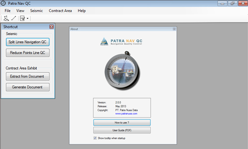
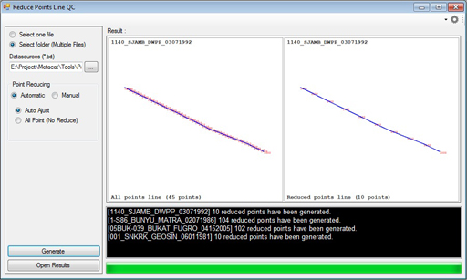
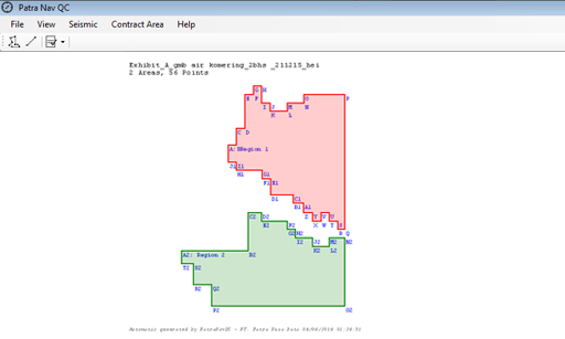
Patra Nav QC is a desktop base application, that process navigation data of geographic coordinate into the better quality one. Data that is processed in form of seismic survey data and petroleum contract area map (Working Area/WK).